An early morning hike through Monument Valley was the start to our day. The key is to start at sunrise and finish before it gets too hot. Unfortunately, we got off to a late start at 10:00 a.m.
The first couple of miles were very pleasant as we trooped through the desert landscape of sculpted rock monuments and cacti. Around noon we started the final mile and it was hot. Our two litres of water were finished and so were we. I'm glad we only had a mile to go or heat exhaustion could have become a factor. On the plus side, Emma was quite placid for the rest of the day.
We recovered and celebrated over breakfast at the excellent Navaho restaurant that overlooks Monument Valley.

Monument Valley with traditional Navajo Hogan in the foreground

Several Black-throated Sparrow and a couple of Ash-throated Flycatchers were in the area but they were weary and didn't stick around for a picture.

West Mitten Butte

We bid Monument Valley adieu and traveled to Navajo National Monument. That name gives me a chuckle because it was the ancestors of the Hopi Indians that built the famous cliff dwellings at Navajo National Monument. Centuries ago the Hopi left and moved south and the Navajo migrated into the area.


Firecracker Penstemon

Tsegi Canyon in Navajo National Monument
We took the one mile Sandal Trail to an overlook of Tsegi Canyon. From there you can see the well-preserved Betatakin cliff-dwelling ruins.

Sandal Trail Overlook

Betatakin Cliff Dwelling Ruins at Navajo National Monument

Close-up of the Betatakin Cliff Dwellings

By the late afternoon we continued northwest to the Colorado River and spent the night near Page, Arizona.
July 15
We heard that Antelope Canyon was a spectacular site to visit. This Navajo-administered park site is on the outskirts of Page. Under the hot Arizona sun, booking the ride to the canyon entrance was challenging. I was overcome by the laissez-faire bureaucracy and went back to the RV for a nap. Emma persevered and negotiated the milling throngs to book our visit. .
The three mile ride to the canyon entrance was worth the price of admission. We went flying over the rutted dessert landscape in the back of an open pick-up truck. I was right by the tailgate and went airborne on several occasions as we hit bumps and ruts along the unmarked trail. A couple of times I thought I would sail clear out the back.

We screeched to a halt as the canyon dead ended against a cliff. Refocusing and regaining our equilibrium we noticed a narrow vertical slit in the rockface.The entrance to Antelope Canyon was only a few feet wide but well over 100 feet high.


In the mid 19th century, the US government tried to deport all the Navajo from their Arizona homeland and relocate them to eastern New Mexico. Some Navajo hid in Antelope Canyon to avoid the round-up.


The ride back from the canyon was just as exciting but this time Emma and I sat right next to the truck cab. We looked back at the tailgate throughout the ride and watched some other poor "tail-end Charlie" sail up and down as we hit the ruts on the way back. I think the driver did it on purpose to add to the excitement and entertainment value of the trip.
Antelope Canyon completed our drive through the magical Navajo lands. It was time to return to the concrete and smog of modern civilization.

We crossed the Colorado River at Page then stopped at the Glen Canyon Dam Visitor Centre.

Big dams fascinate me. The massive scale of the structures represent an amazing architectural and engineering feat. The potential energy behind the dam is almost palpable as you look at the placid surface water. The pressure and depth of the water behind the dam were formidable obstacles to overcome.

The Glen Canyon Dam created Lake Powell, the second largest artificial lake in the USA.


There were lots of people and big boats in the Glen Canyon National Recreation Area. However, that activity does not hold much appeal to Emma and me so we continued along Highway 89 through the Grand Staircase Escalante National Monument to Kanab, Utah.

Grand Staircase Escalante

Grand Staircase Escalante
July 16 and 17
We spent a day at the Kanab campground relaxing and reflecting on our experiences in Navajo country. On the 17th, it was time to journey down to the north rim of the Grand Canyon.

Small buffalo herd near the Grand Canyon

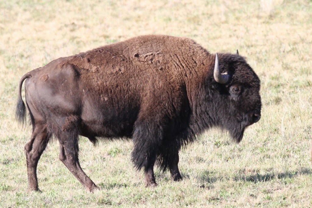
Bull Bison

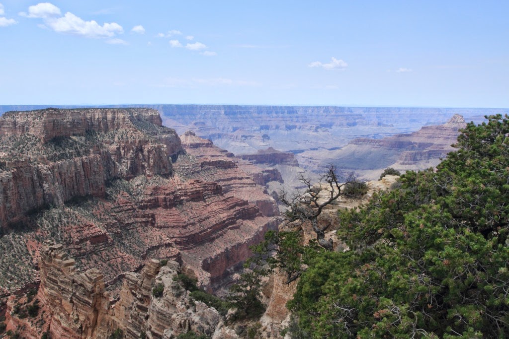
The Grand Canyon from the North Rim

Bright Angel Point - North Rim

Emma at Bright Angel Point


Grand Canyon Lodge

Angel's Window at Cape Royal on the North Rim of the Grand Canyon

Angel's Window at Cape Royal

Angel's Window

Cape Royal - North Rim of the Grand Canyon

Common Raven
Cape Royal - North Rim of the Grand Canyon


Wotan's Throne by Cape Royal in the Grand Canyon

Wotan's Throne

Emma at Cape Royal

The Colorado River


It was a very pleasant jaunt through a Ponderosa Pine forest and along a section of overhanging cliffs.

Western Tiger Swallowtail


Water was seeping out of the sides and ceiling of the cliff face.


Toward sunset we headed north back to Kanab, Utah.
No comments:
Post a Comment