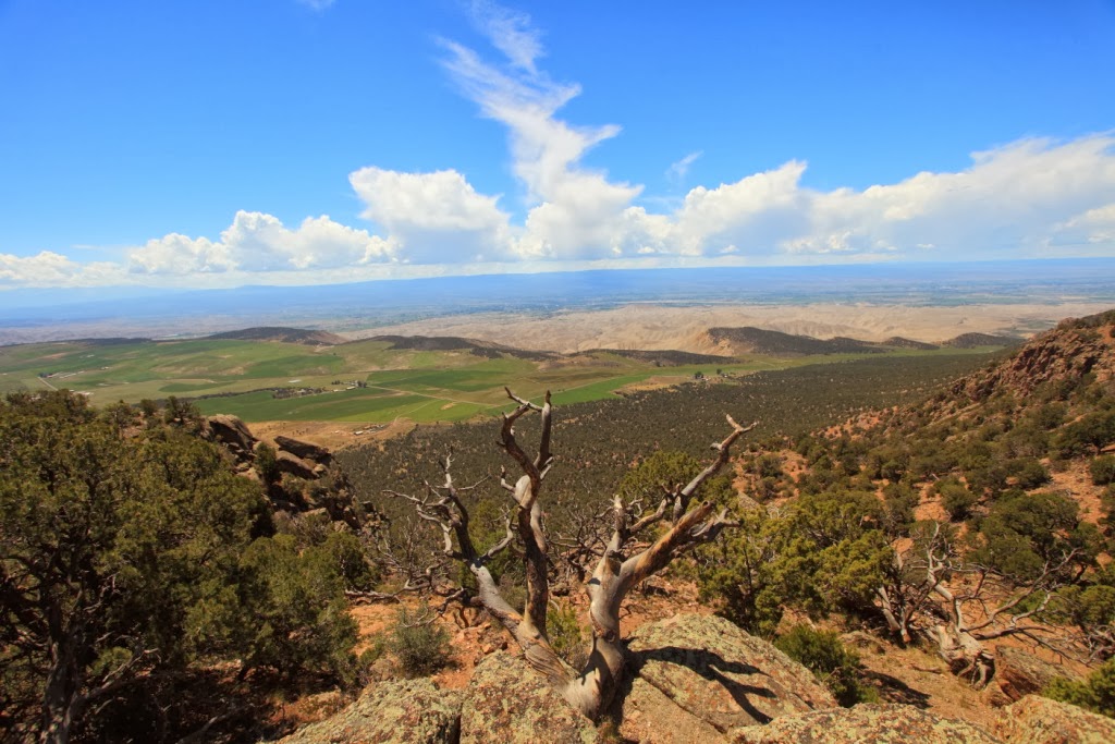
Before we left Mesa Verde, we had a nice hike to a viewpoint overlooking the valley below.
Starting up the Point Lookout Trail.
As we started up the trail, a pair of 17) Scrub Jays were making a racket in a dense bush. I approached the bush and an immature Cooper's Hawk flew out. He clearly had dinner on his mind and the Western Scrub Jays were not impressed.
18) Cooper's Hawk
A nearby squirrel was watching intently to ensure that the dinner menu did not shift from fowl to rodent.
Ascending Point Lookout Trail
Celebrating at the Summit.
View from the lookout of the road descending from Mesa Verde
Other birds seen along the trail include: 19) Clark's Nutcracker; 20) Black Swift; 21) Peregrine Falcon; 22) Chipping Sparrow; 23) Red-tailed Hawk.
Chipping Sparrow
We headed out of Mesa Verde along I60 to Durango. We were headed to the Black Canyon of the Gunnison National Park so we took the San Juan Skyway Scenic Byway. We had no idea what we were in for.
The terrain became quite mountainous and the views spectacular. Unfortunately, it was misty and raining hard as we endeavoured to stay on the winding mountain road. I had little time to contemplate the majestic views as job one was to stay connected to the highway.
Emma described the 10,640 foot high road to Coal Bank Pass as wet, windy and windy with sheer drop-offs and no safety rails. Emma's anxiety maxed before we were half way up and I was receiving a constant flow of driving suggestions.
Topping the pass we plunged down into the valley below then back up to Molas Pass at 10,910 feet. The turns were serpentine with posted speed limits of 15 and 20 mph as you revolved around 180 degree turns. Emma was shaking and quaking but silently stared straight ahead as we dropped into Silverton.
It was pouring rain when we took a breather in Silverton. Unfortunately, there were no RV facilities available so our only option was to continue to Ouray.
"How is the road to Ouray?" I asked one of the locals."You just finished the easy part", he said, "Silverton to Ouray is the tricky part but it's very scenic".
According to Emma the ride from Silverton to Outray was quite pleasant and much easier than the first half of our trip. Mind you, she had popped a couple of Ativan at our Silverton rest stop. Boy, that must be a powerful drug because I was white knucking the drive the entire way. Cresting Red Mountain pass at 11,018 ft, I silently prayed for divine guidance along the slippery road back down. The speed limit on the switchbacks dropped to 10 mph. Emma maintained a running commentary on the beautiful views offered by the sheer drop-offs. Under the circumstances I thought it best to nod and agree despite the worsening conditions.
We finally made it to Outray and the flat valley beyond. I pulled over to recover and regroup. Emma continued to happily chat about a wide range of innocuous topics. She was happy and I was happy we made it.
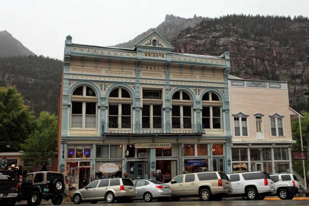
Downtown Ouray
Storm Drain Running Through Ouray
We walked around the historic town of Ouray. The large storm drains were a testiment to the torrential rains they get here. I was also impressed by a hummingbird feeder where a number of 24) Broad-tailed Hummingbirds were feeding.
As we left Ouray the view out my rearview mirror was amazing. The majestic snow capped San Juan Mountains towered over the small town nestled at their base.
At dusk, we arrived at our campground in the Black Canyon of the Gunnison National Park.
August 11, Sunday
It was a clear sunny morning at the Black Canyon of the Gunnison and despite the elevation of 8,320 feet the day was pleasantly warm.
The View down into the Black Canyon of the Gunnison was impressive. The steep, black canyon walls beautifully frame the Gunnison River which surged far below.
At its high point, the Gunnison gorge drops 1,700 feet to the canyon floor. The first explorers rafting through this canyon were taking their lives in their hands.
As you approach the canyon it seems like you are on a rolling plain of Gambel Oaks and Juniper then suddenly you are beside the edge of a steep narrow canyon.
At the High Point lookout, we did the 1.3 mile Warner Point Walk. We got an excellent view of the Gunnison River flowing out of the canyon and into the wide valley beyond.
Emma on the Warner Point Walk
Jim and Emma at the Black Canyon of the Gunnison
Birds around the canyon include: 24) Golden Eagle; 25) White-throated Swift; 26) Stellar Jay
Golden-mantled Ground Squirrel
Desert Cottontail
Gunnison River
The Black Canyon of the Gunnison was recently raised to National Park status and is very worthy of the promotion from National Monument status.
27) Fledgling Green-tailed Towhee
28) Warbling Vireo
When we got back to our Gunnison campsite, we discovered that someone had taken our camping spot. Fortunately, the camp host came to our rescue and found us another site.
August 12, Monday
We left the Black Canyon of the Gunnison and drove back to Montrose. As we headed up to Grand Junction, we decided to detour through the Colorado National Monument.
Wow. The road up the red rock canyon was amazing as was the climb up the canyon onto the mesa above. That was one steep and windy road. Once on top of the mesa, the road wound along the cliff edge so you could have a good look down into the canyons below.
In a spare Juniper forest, we stopped for a picnic. I wandered about outside the RV as Emma prepared lunch. I usuually have my camera gear with me at all times but not this time. I heard some squawking in the forest and wandered along a trail to investigate. A noisy group of jays was feeding and moving away as I approached. They kept well hidden in the Junipers so I couldn't confirm their species. Suddenly, the look-out jay perched directly beside me not 20 feet away. It was a lifer for me, a 32) Pinyon Jay, and my camera was back in the RV. We eyed each other for about 30 seconds then it called out and the whole flock took off.
Memo to self, always take your camera.
Wow. The road up the red rock canyon was amazing as was the climb up the canyon onto the mesa above. That was one steep and windy road. Once on top of the mesa, the road wound along the cliff edge so you could have a good look down into the canyons below.
Cold Shivers Point - Colorado National Monument
In a spare Juniper forest, we stopped for a picnic. I wandered about outside the RV as Emma prepared lunch. I usuually have my camera gear with me at all times but not this time. I heard some squawking in the forest and wandered along a trail to investigate. A noisy group of jays was feeding and moving away as I approached. They kept well hidden in the Junipers so I couldn't confirm their species. Suddenly, the look-out jay perched directly beside me not 20 feet away. It was a lifer for me, a 32) Pinyon Jay, and my camera was back in the RV. We eyed each other for about 30 seconds then it called out and the whole flock took off.
Memo to self, always take your camera.
Ute Canyon - Colorado National Monument
Ute Canyon - Colorado National Monument
Artist Point - Colorado National Monument
Monument Valley - Colorado National Monument
Grand View Overlook - Colorado National Monument
Grand View Overlook - Colorado National Monument
Grand View Overlook - Colorado National Monument
Grand View Overlook -Detail
Our anticipated short excursion through the Colorado National Monument ended up taking most of the day. This place is spectacular and well worth a longer visit. Don't plan to motor through this park as the road is serpentine with magnificent viewpoints at every turn.
As the sun was setting we set up camp just east of Crescent Junction, Utah.


No comments:
Post a Comment